
| When: | Saturday, May 3rd |
| Time: | Meet 7:00-7:30 am. Start hiking promptly at 7:30 am. |
| Duration: | @5-8 hours |
| Meet Location: | Manker Flats Campground area. (Same start as TH#2) |
| What you need: | Walking/Hiking shoes, backpack, plenty of water, plenty of food, sunscreen, bug repellent (maybe). Read below for other info on what to bring. |
| What you need to know: | I went up to that area Sunday, April 27th, and didn't see any real problems. It was very windy in many spots, and it was coming off the snowy north facing slopes, which made it chilly. It might be different weather on Saturday, but I would suggest having a pair of light gloves and something to cover your head. Caps or hats could be blown off if it's a windy day, so be ready for that. See pics and other info below. |
| Other Information: | The plan is to hike the service road to Baldy Notch (3.6 miles), after a short break, go to the summit from there (3 miles), come back to the Notch (3 miles), and ride ski lift down ($8 one way, $15 both ways). Then there will be another 1/2 mile or so to get back down to the cars from the ski lift parking lot. If we can get a couple people to park at the ski lift lot, then bring them back to Manker parking area, we could have a shuttle or two back to the cars. For those who might be joining us for the first time, email me for specifics, or use the same instructions as TH#2 or below: The directions below get you to the ski lift parking lot, but we will be parking about a 1/2 mile BEFORE the ski lift parking lot. Parking is in dirt areas near the Manker Flats Campground. The dirt road we will be hiking is on the left. Email me if you need more specifics. |
| Directions: | Mt. Baldy Ski Lifts |
| Carpool/Meet Spot | Stater Bros. 1619 N Mountain Ave Upland, CA 91784 We leave here at 6:45 a.m.! |
| Summit hike #1 is in the books. The weather was great and 10 of the group made it to the summit. | |
 |
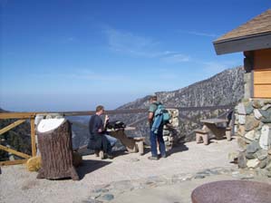
The group congregating and discussing the dilemma with the following summit hikes. (See Summit Hike #2) (Photo courtesy Sonya) |
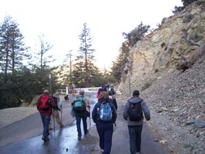 |
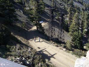
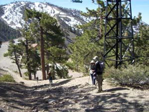
The group headed up the service road we used for TH#2, 3.6 miles from parking to Baldy Notch. Miles: 10 |
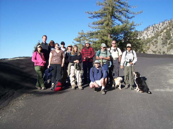 | |
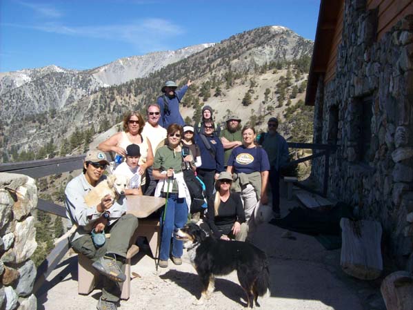
| A little ways up, we decided to get a good group shot in the sun. Only one not in the pic is Kathy, who had started a little early. | |
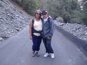 |
Lori & son Jake were only able to attend 3 training hikes, but were ready to tackle the tough hike. (Photo courtesy Sonya) |
 |
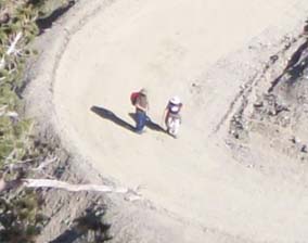 |
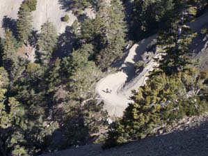
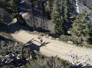
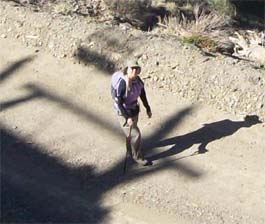
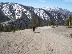
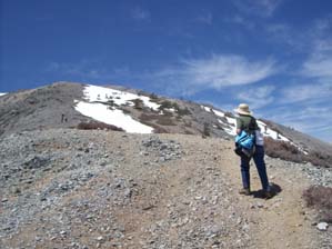
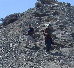
| There's good elevation gain even on the service road, and I spied on Kat and Alan from up above. | |
 |
Steve & Aaron were the first 2 to the Notch, and enjoyed a little peace just before a boy scout troup of about a 20 kids & adults arrived on the ski lift. |
 |
 |
| Lori & Jake trucking along, arriving at Baldy Notch. | |
 |
 |
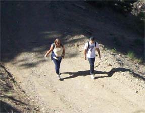
| Sonya moving along right behind them. | |
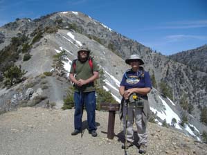
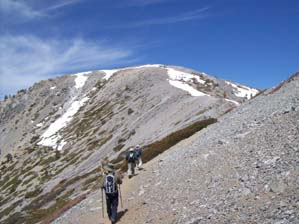
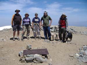
 | At Baldy Notch, we got the whole group in the shot. Dan is pointing the way, up, up, up. The summit can't be seen, it's just behind the prominent peak. |
 |
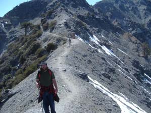
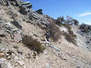
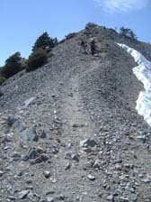
The first section is ridiculously steep, it's a ski slope afterall. This is looking towards the top of it. |
 |
This is looking back, with Kat, Alan, Kathy & Sonya showing how steep it was. |
 |
 |
| Megan nearing the end of the tough climb. | |
 |
The start of the real scary...uh, fun hiking. (Photo courtesy Sonya) |
 |
Alan posing in front of the steep exposed section. Kat up in the background. (Photo courtesy Sonya) |
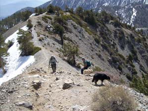 |
John & Steve, with John's dogs taking in the sights. |
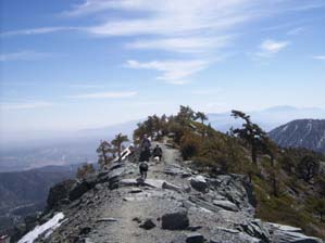 |
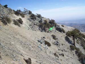
A nice view was definitely to be had. Some enjoyed the view and exposure...some not so much. |
 |
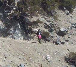
John & dogs on the narrowest part of the trail. |
 |
Steve on the narrowest part. I kept yelling at him and throwing rocks, trying to distract him, but he stayed rock solid all the way across. |
 |
 |
| I thought Iscela was pondering crossing the narrow trail.....but on closer inspection, found out she was just admiring the tangled twisted tree! | |
 |
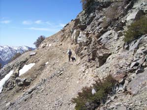
Kat & Sonya about 5.6 miles up, coming off of the exposed section of the Devil's Backbone. (Photo courtesy Sonya) |
 |
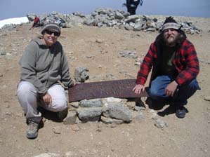
Thar she is, the Mt. Baldy summit! These folks aren't in our group, but they gave me $5 each to take their picture. |
 |
Lori & Jake and Kathy got close, but after 6.5 miles of tough hiking, they looked up at the last and hardest section and said, "Next time!" (Right Lori, Jake & Kathy, next time...right?!) I was only able to get a pic of Kathy as she was about 25% up the steep last section. |
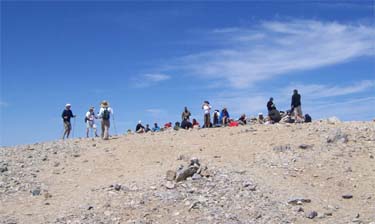 |
We were definitely not alone on the summit. This picture doesn't do justice, as there were about 50+ people up there at one point. |
 |
Dan...exhausted, but on top. (Photo courtesy Sonya) |
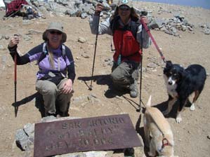 |
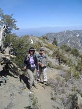
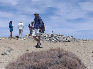
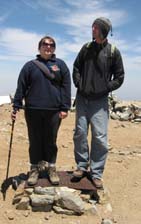
Sonya & John with the famous sign- "Mt. San Antonio- "Mt. Baldy" Elev. 10,064" (Photo courtesy Sonya) |
 |
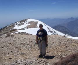
SONYA |
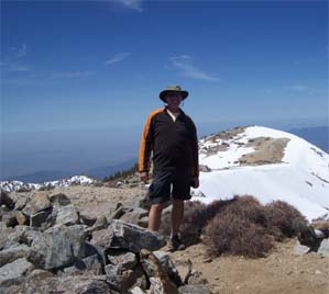 |
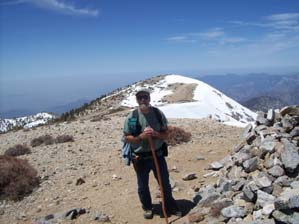
DAVE |
 |
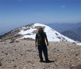
AARON |
 |
ALAN |
 |
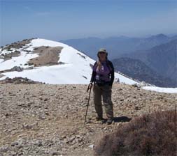
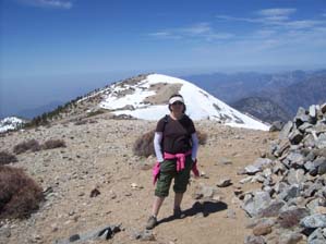
KAT |
 |
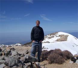
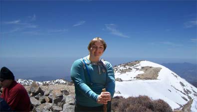
JOHN |
 |
STEVE |
 |
ISCELA |
 |
MEGAN |
 |
Megan & Aaron getting higher in elevation than everyone else! (Photo courtesy Dave) |
 |
Kat & Alan touching the top. (Photo courtesy Sonya) |
 |
Dave, Sonya, Kat, Alan, John (Photo courtesy Sonya) |
 |
|
| Kat & Alan coming down from the summit. It was TOUGH going up too!(Photo courtesy Sonya) | |